Property for Sale in Colestin Valley, California
Description of the area:
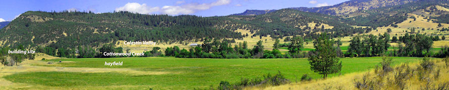
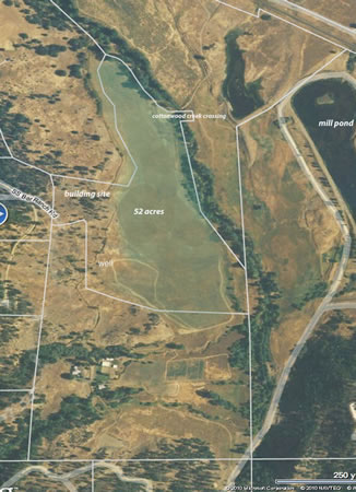
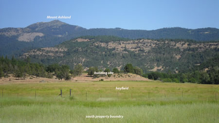
I own two parcels of land just south of Ashland, on the California/Oregon border, about 2 miles from I-5 interstate. Both of these parcels are part of the old SS Bar Ranch in the Colestin Valley (altitude 2900 feet). This valley runs from the California/Oregon border up the Siskiyou mountains toward Mount Ashland. The minimal parcel size in this region is 40 acres. I live on one parcel of 73 acres, which I use for a grass hay field, an organic asparagus field and where I keep several horses. The adjoining property of 52 acres is for sale.
Description of the property:
 |
-
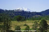
Mt Ashland - South Boundary
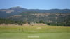
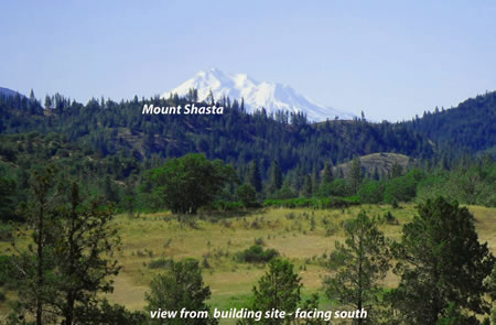
 Mt Shasta View
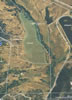 Parcel Map
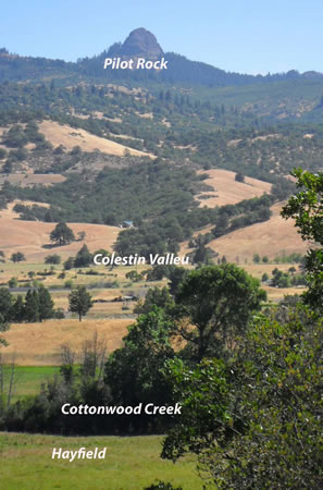
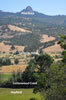 Pilot Rock - Facing East
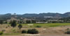 Pilot Rock - West Boundary
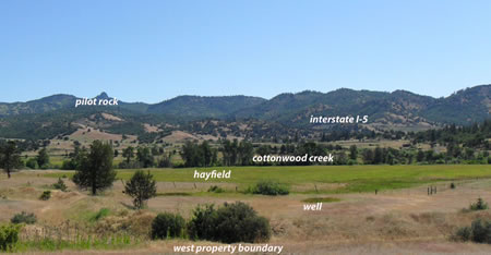
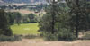 View From Building Site
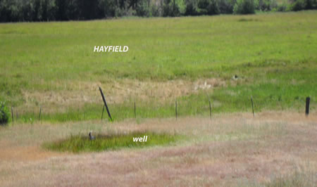
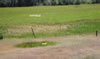 Well Facing Northeast

 |
52 acre parcel, Colestin Valley, California. (Although this parcel is for sale, we are not listing it at this time. We are being selective in our prospective buyers as they will be our neighbors.)
This 52 acre property is prime agricultural land. About 40 acres is a productive hay field with flood irrigation. This field is fully fenced, and we currently lease it to local ranchers for hay production and cattle grazing on an annual basis. This parcel has riparian water rights from year-round Cottonwood Creek which flows down Colestin Valley and eventually empties into the Klamath River to the south. Water from Cottonwood Creek moves from a diversion ditch along the west side of the hay field for flood irrigation. This parcel also crosses Cottonwood Creek at one point, with associated riparian water rights there also.
The remaining 12 acres are on a rise overlooking the hay field. These acres are partially wooded, have an approved building site with valley views and views of Mt. Shasta, Mount Ashland, and Pilot Rock. It is a very private location. The phone line crosses the building site (underground), and electric power comes to edge of property (about 150 feet from building site). There is also a well on the property, which we have never used – but it was tested at 9 gal/minute when it was drilled in 1990, and water in the well pipe actually comes to the surface without pumping. The 40 acre hay field is not rocky, nearly level and drains well in the winter. It is ideal for pasture, many kinds of farm crops, equestrian facility, etc.
The property is 25 minutes from Ashland and easily accessed from I-5 at the first off ramp on California side as you drive south from Ashland, (the "Hilt" off ramp.) It takes about 7 minutes on the paved and graveled road, to drive from I-5 to the property. This property is one of ten parcels that is accessed from the one mile long SS Bar Ranch Road. Our group of property owners comprise the "SS Bar Ranch Road Association" and as such, we meet once a year to discuss and fund road maintenance. Recent annual fees have been $200 to $300 per year, which includes road grading, gravel, snow plowing, and contribution to the volunteer fire department. We have one of the best roads in the valley.
Please contact me at bobcatmeadowfarm@gmail.com if you have any questions.
Maps of SS Bar Ranch Road, Hornbrook, California 96044
| Map | Satellite Map |
View Larger Map |
View Larger Map |